Capabilities
Custom topographic installations and furniture in wood and metal at any scale.
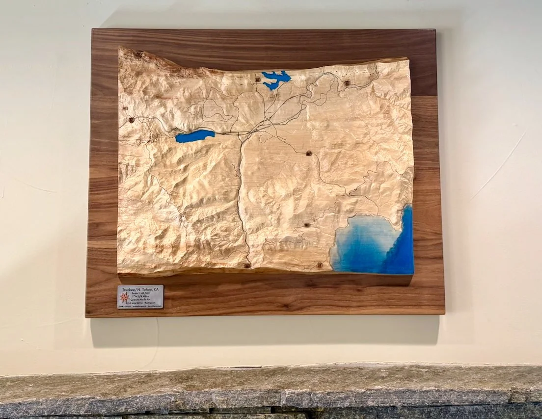
Terra Ligna creates bespoke topographic works in wood and metal for residential and commercial design projects.
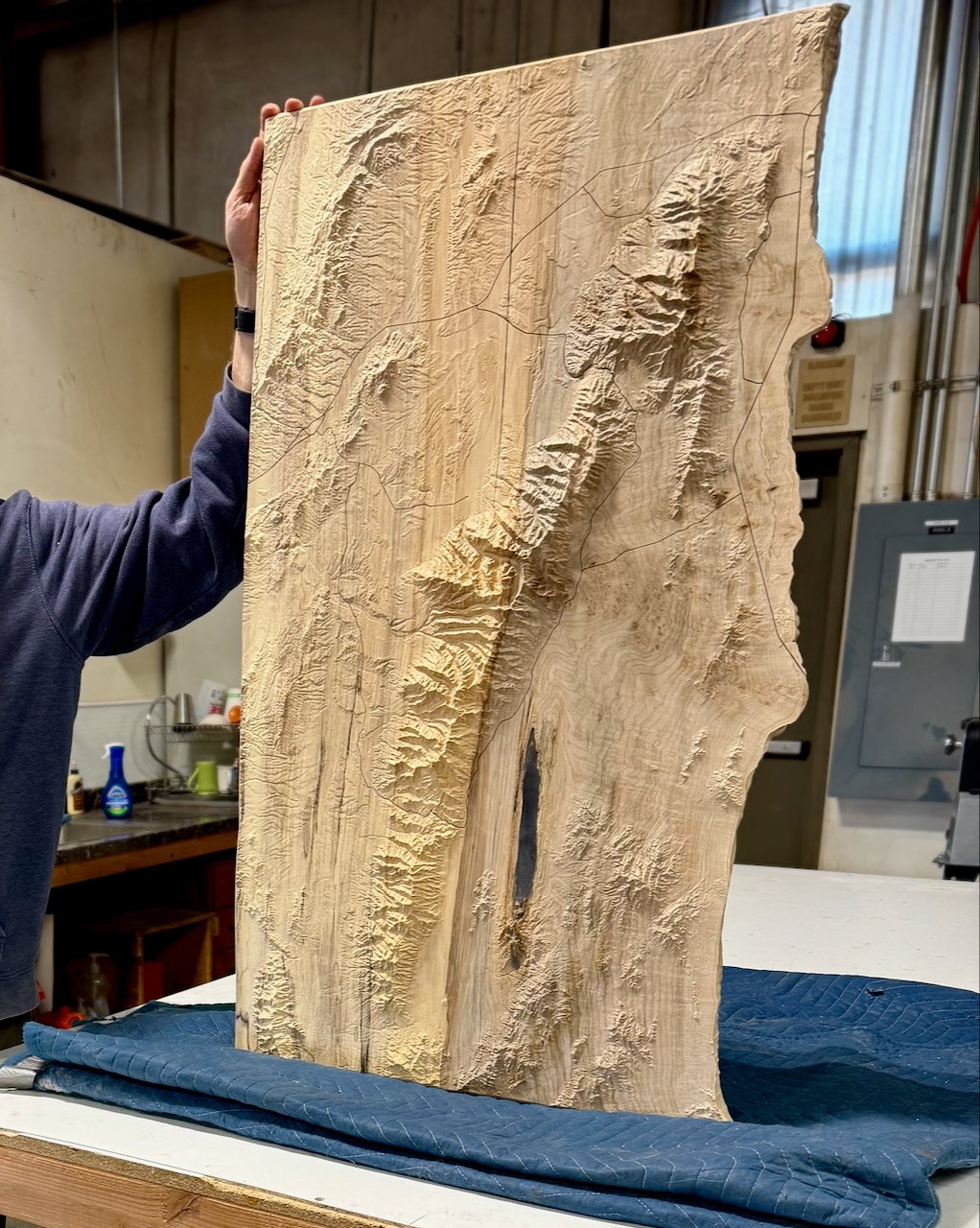
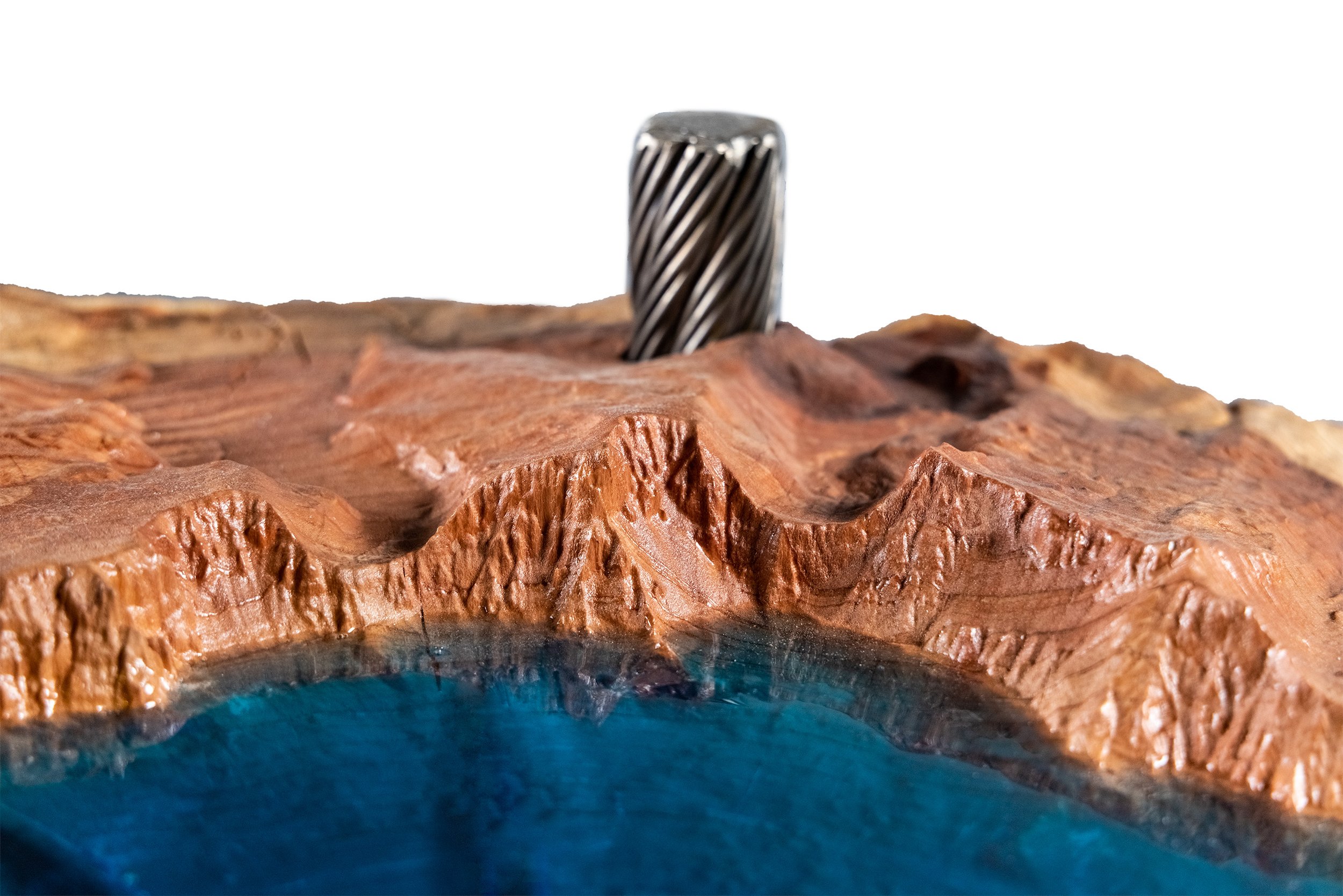
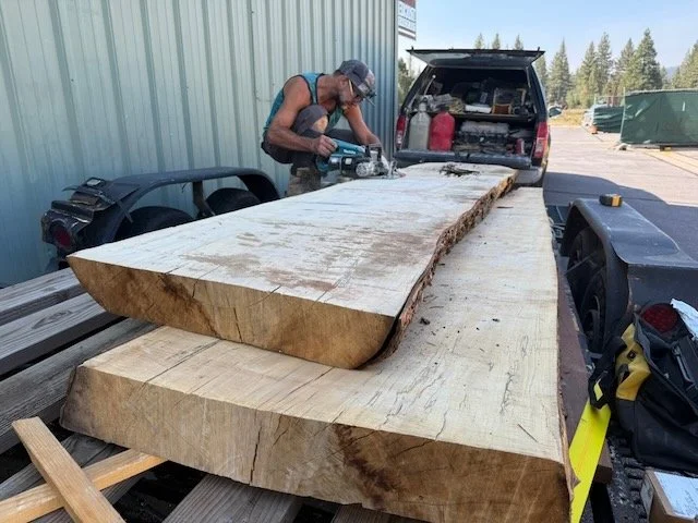
We sustainably source reclaimed hardwood logs and mill them to spec for each project, as well as upcycling ski resort chairlift haul rope cable for our functional furniture pieces.
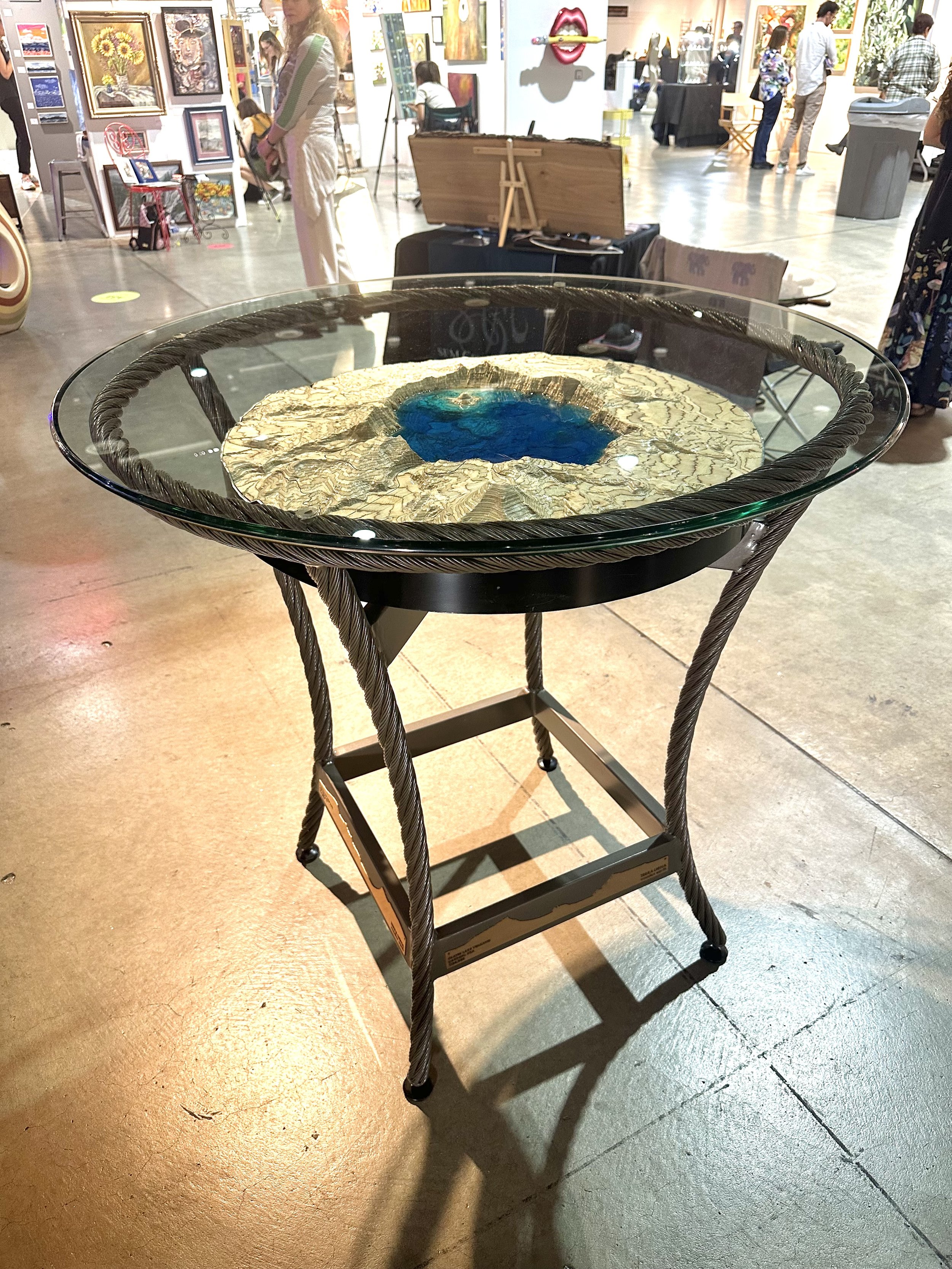
Functional Map Furniture
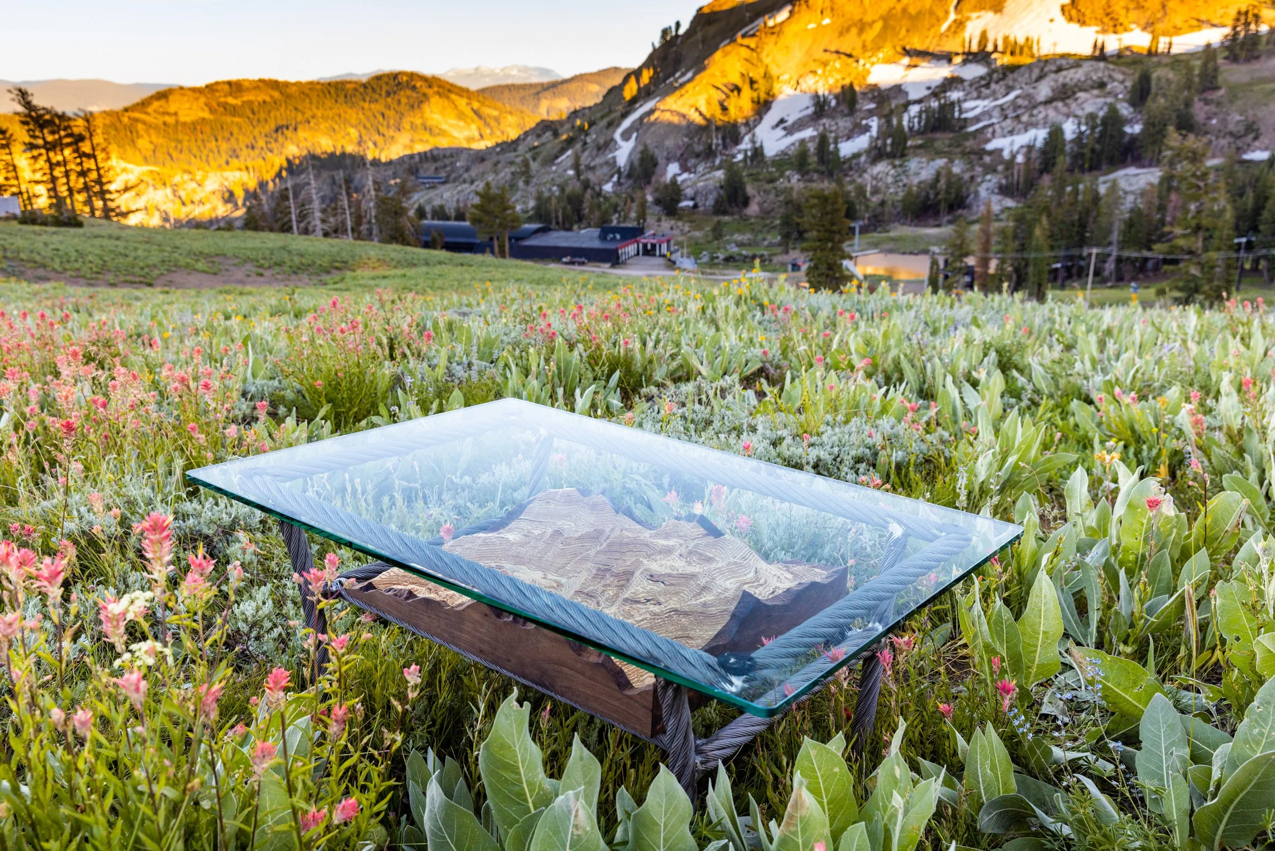
Glass-topped map tables
Dining and conference tables
Boardroom centerpieces
Custom bases in hardwood, steel, or reclaimed industrial materials
We engineer each piece for structural integrity, using wood and steel to fabricate map supports that showcase our maps and the high-fidelity surface of the terrain.
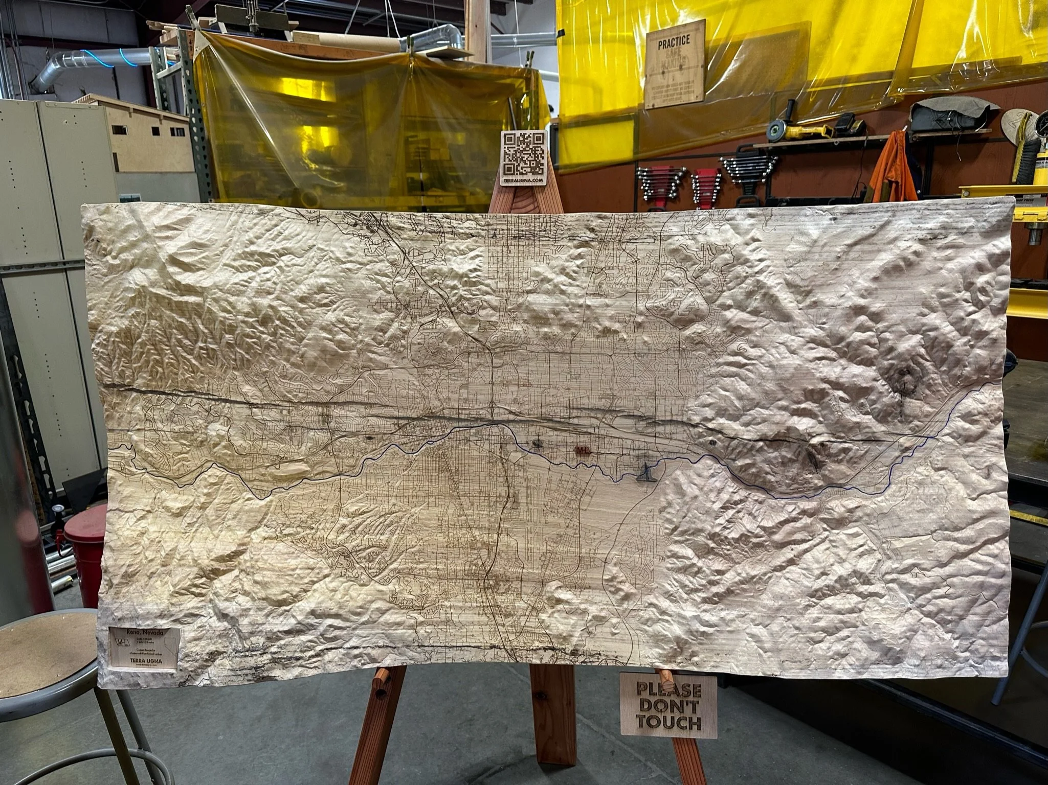
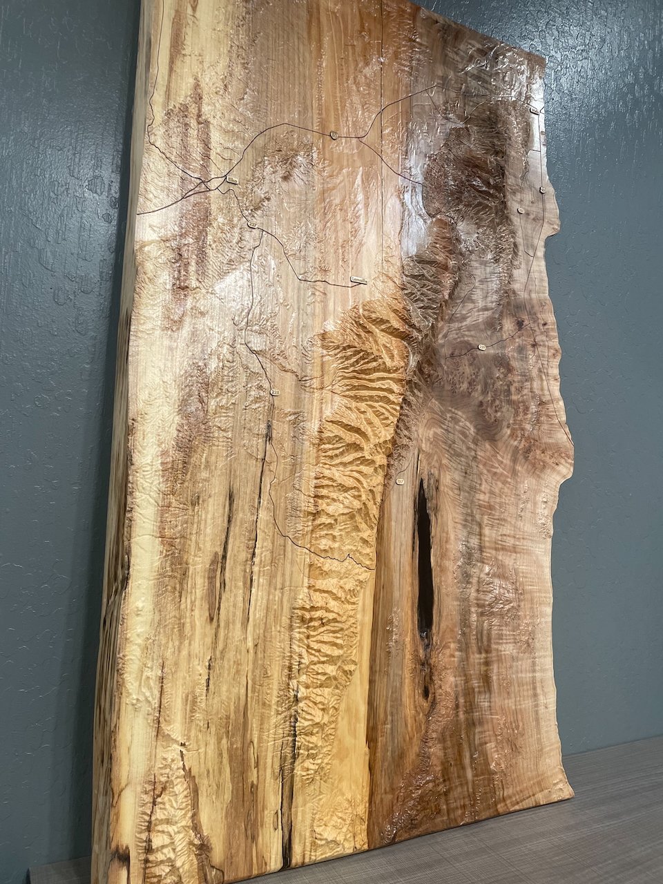
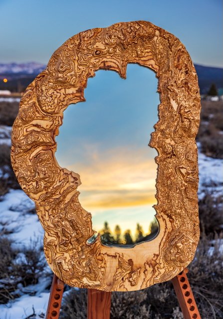
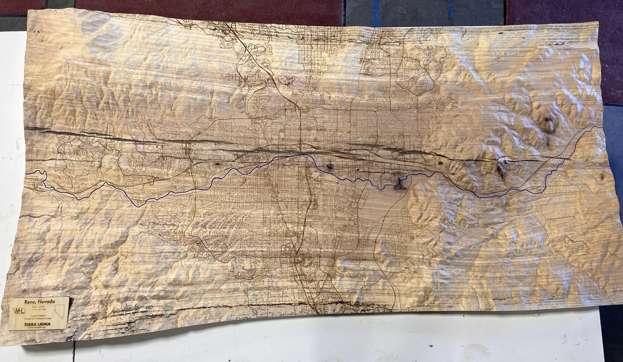
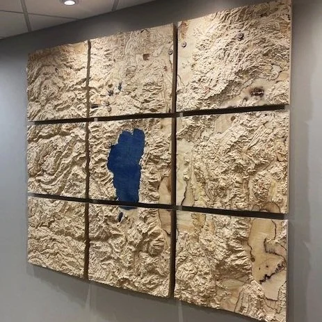
Custom Paneliized Map Installations
Large-format carved topographic panels
Multi-panel architectural installations
Minimalist gallery-style presentations
Framed or frameless floating systems
Integrated lighting-ready designs
Scale ranges from intimate 24” works to expansive multi-panel installations exceeding 10+ feet
Materials
We work in:
Custom-milled hardwood slabs and select softwoods
Maple, ash, American elm, oak, walnut, redwood and sequoia
Laminated Baltic Birch
Reclaimed architectural materials
Glass, steel, and braided cable integrations
Material direction is determined in consultation with the design team to complement flooring, cabinetry, stonework, and lighting.
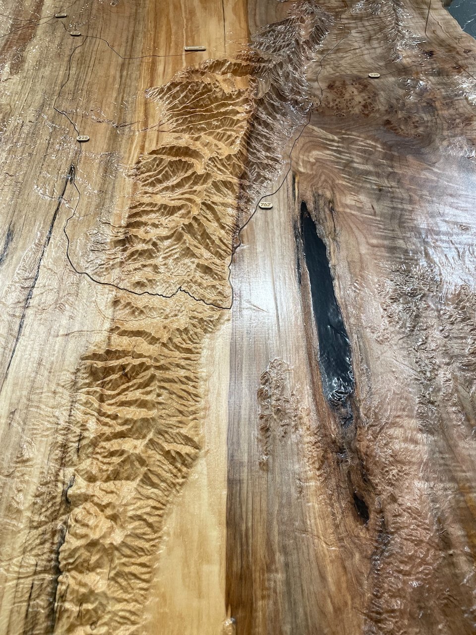
Precision Terrain Modeling & Custom Geographic Scope
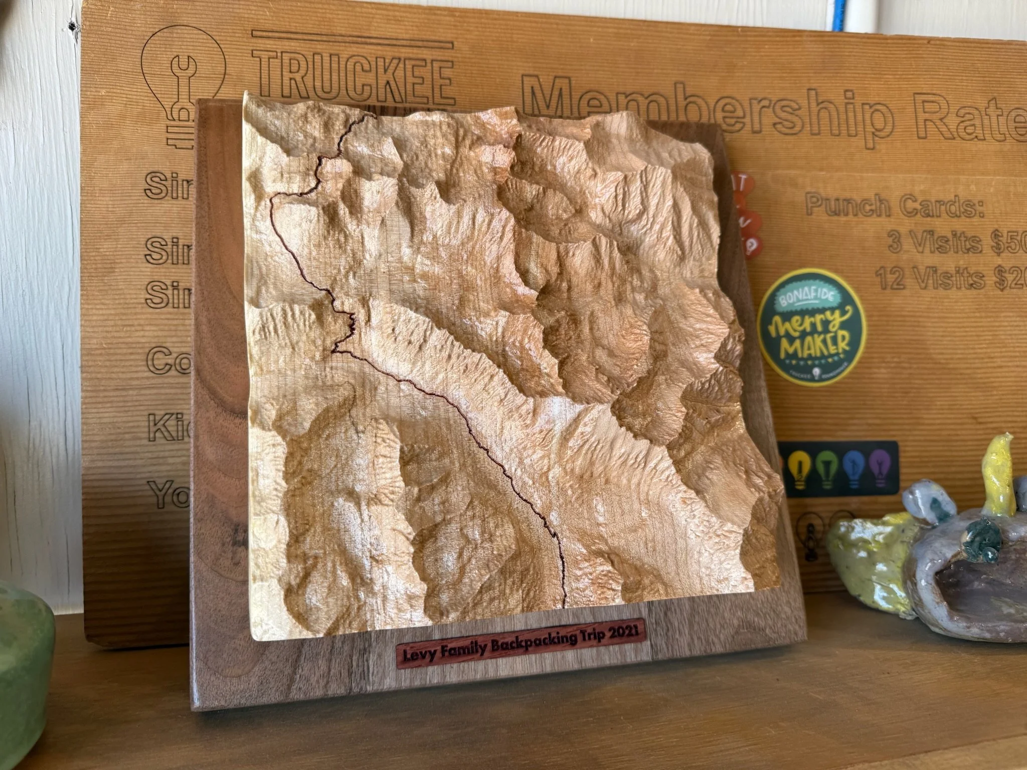
We produce highly detailed three-dimensional terrain models from the highest-resolution elevation datasets available. Scale, relief exaggeration, shoreline treatment, and labeling density are customized per project. This allows for:
Accurate site-specific representation
Artistic reinterpretation of meaningful landscapes
Minimalist or information-rich cartographic approaches
We create terrain models of mountain ranges, coastal regions, islands & lakes, ski resorts and alpine basins, as well as national parks and private properties
Installation and Global Delivery
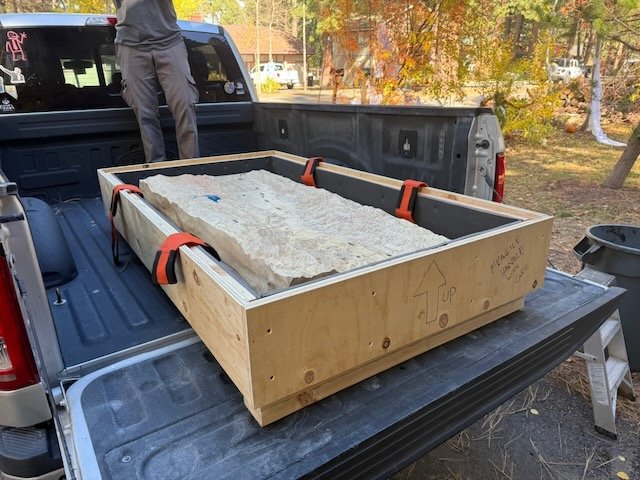
We offer white-glove installation throughout the Lake Tahoe and Northern Nevada region.
Beyond our area, our maps and furniture can be crated and shipped worldwide for residential, commercial, and hospitality projects.